
The distant Drakensberg escarpment from the start gate
The X-Berg challenge (with live tracking) took place over six days from Sunday March 16th, 2014. Pierre Carter from Johannesberg has competed in the xalps three times and last year a smaller event was held partly as training for his xalps 2013 bid. This year a six turn point 186 kilometre course was set, from north to south, predominantly extending across the eastern border of Lesotho. The area features a commanding near continuous escarpment rising over three thousand metres above sea level and separating the arid mountains of Lesotho from the thunderstorm watered grasslands of South Africa. The setting was dramatic and for our event the weather proved challenging and I had some very interesting and rewarding flying.

Sorting my food cache – only two of five were used
DAY ONE

Graham, Vanessa, and Shane early on day one
Shane, Graham, and myself started just before the agreed time of 9am while due to a late rule change the others were scattered ahead of us in an elapsed time start. The first turn point was 2.5 kilometres away from the Drakensberg main range and we saw Pierre jog back past us just before we started. We were surprised by a brisk northerly wind… every time I’ve asked a local about the weather they’ve shrugged or mentioned yr.no or windfinder / windguru which I find far too specific to be useful. Post X-Berg I’ve used South Africa’s government website forecasts for Giant’s Castle which is at least in a language I can understand. But anyway we assumed it would be a long days walk to the second turn point, about 29 kilometers away under Sentinel Peak.

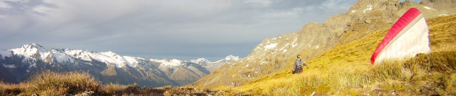
Trying to fly over the gorge, Sterkfontein dam
At lunch time although the wind was still strong I thought it seemed thermic and decided to throw my hat in the ring and fly. I had been moaning about doing road miles weeks before even starting X-Berg, and throughout the race I would always push for exploration and discovery by way of trying the air, even if it’s probable that walking would be just as fast. It is a much better way to absorb the scenery and enjoy your trip; it’s a good exercise in figuring out the air and putting your judgement to the test; and I’m sure not going to carry my paraglider all for nothing.

Graham and Shane walking in strong winds
So while Shane and Graham ate, ummed, and aahed, I bobbed around above them with the vultures (but more like a jellyfish Shane said) usually with some forward speed, rarely using speed bar but glad to have it nonetheless. I was trying to cross the very impressive gorges in front of me by pushing into headwind, and for that I needed a thermal. There certainly was lift around but due to the wind any lift was short lived bullets followed by sink which prompted me to retreat to the ridge. So when Vanessa (Graham’s supporter) started returning and Graham and Shane evidently decided not to join me and walked on, I top landed, packed up, and followed.
We were energised by the scenery, sandstone escarpments that contour the lower levels of the Drakensberg. Two hundred million years old the layers of sedimentary rock are topped with volcanic basalt that is crumbling away. Predominantly grassy there are usually enough livestock trails to follow, although the lack of sign posts, overgrown gullies, and near hopeless phone reception make the European Alps a very civilised alternative in comparison.

Evening glides as the winds drop
As the sun lowered the wind dropped a touch and I decided to fly across a small grassy valley. The others agreed to do the same, they must have been eager to dust the cobwebs from their wings. After years of vol biv experience I am well versed in packing and unpacking my glider quickly and I had already reached the next valley with my paraglider in a rosette by the time Shane and Graham launched. Here I waited, as the topography was a little less forgiving. We eventually carried on around the corner and with the sun almost set the wind was hardly enough to launch. Stressing the importance of recognising a two minute window and acting fast I was off.
After crossing numerous gnarly gulches with a short glide I face landed, ground handled up the slope, and took off again, just high enough to get some lift before making another glide. I continued, running with the wing overhead along the slope after landing, taking off again wagga style, and making as many metres as I could before the wind completely died. Finally I climbed a small hill and went for a final glide (the wind was so light by now that I broke some lines on the rocky launch, virgin damage to my new glider) to an African village, thus giving myself a clear lead on Shane and Graham who also flew but were left behind.
After I’d informed the African villagers that I didn’t need them to accompany me all the way to the hotel I continued on walking into the night, washing in a stream, navigating shepherds paths, enjoying distant lightning flashes, and appreciating the moonlight on the slope when the clouds started to dissipate. Soon after 8pm I reached the hotel and settled down for a good meal – lasagne, salad, and a milkshake. I then continued up the hill following a partly sealed road and even enjoying it. I reached the turn point at the road end with just five minutes to spare before the 11pm to 4am curfew. Pierre welcomed me along with a couple of other slumbering pilots in the hut and I swallowed a few cans from my food cache (a trailer is left at each turn point) before going to sleep.
DAY TWO

Sunrise on Sentinel peak from turn point two
I woke to find that Graham and Shane had also reached the hut. They’d taken a possibly more convoluted route along the ridge and since they arrived late they had to backtrack in the morning to the point they’d reached at 11pm. I enjoyed the extra sleep in and then joined them to climb up beside Sentinel peak. We reached the high plateau in Lesotho shortly after 9am, congratulating ourselves on generally being terrific and wondering how Joe the other LM5 pilot could ignore such an amazing feature as a continuous 3000 metre vertical sun facing cliff, with his early morning glide down into the valley.

Climbing up the chain ladder toward Lesotho
We started to notice higher cloud had a westerly drift, and I noted that these things tend to mix down as it becomes more thermic. Unfortunately for us by now the escarpment beside us, facing Grand Natal park, was a wall of cloud, preventing us from launching even if we were to face the increasing breeze before turning 180 degrees and peeling off over the edge. Particularly as we felt every metre over the undulating plateau I thought I might even be slightly nauseous with altitude sickness. We began to question our wisdom and looked for a pass off the plateau so we could launch beneath the clouds.

Graham and the terrifying ravine
Stumbling past Lesotho shepherds asking for sweets, we came to the edge of what we thought was the pass. Cloud blocked views of a terrifying ravine. Time to have another bite to eat and check the map (again). Then I noticed a partial clearing of the cloud and my mood suddenly changed – perhaps the nausea had had nothing to do with altitude sickness at all. “I’m launching here!”, I declared enthusiastically. Shane thought he saw a friendlier place on the map and we all agreed that it would be better to fly together so all of a sudden my gear was back in my bag and I was bounding up the slope ahead of them.

Plan B, launch off the Singati wall
Shane’s spot was too flat, until the sheer drop of the escarpment, but this side of the spur was better as it was clear of cloud. We dropped the packs and looked around for a better spot and finally I found somewhere we all agreed on. A good slope to launch with a drop out option to the left if you wanted to abort flying over the main escarpment, a drop of several hundred metres, to the right. Just as we were all setting up we heard the rumble of thunder! It came from the cloud that we’d walked past earlier that morning over Grand Natal. Hmm.
I reasoned that I intended to fly the other way and I’d be gone in two minutes, but everyone has to make their own decisions. Before launching I saw forked lightning dead ahead, but counting the seconds it was about eight kilometres distant. I decided to go for it and I’m glad that I did. There were showers in the vicinity of the lightning and we thought there may have been showers around the corner to the right but it was only bush fire smoke. As it turned out Graham and Shane hesitated and both had long walk outs, Shane injuring his knee in the process (despite walking poles!).


I had a beautiful glide over an enormous amount of terrain. There was some lift but mostly I was just happy to get away from that cliff and that storm. One valley was so full of smoke you couldn’t see all the way across until you were already in it, but there wasn’t a drop of rain. I face landed near a pass, walking up to launch again on the other side. The day had big clouds and shadows and periods of overdevelopment and showers interspersed with hot sun, so by the time I flew I regretted it as had I been a little higher I may have been able to get up. Lift teased during my descent and I landed in the valley short of a sunny spur leading up to Cathedral peak.
Just before landing I gently shouted as to give away my position to an African lady with her back turned. I didn’t want to startle her as she was carrying a load on her head but as it was she barely raised an eyelid. I packed up and walked through the African village with the thatched roofs – it felt very authentic. Then I climbed up to the spur in the hot sun. Conditions were light and fickle though and I had the wing laid out for some time, just beneath the sandstone bluff line, until finally it overdeveloped up Cathedral peak way and a 20 knot gust front (for about ten minutes) prompted me to pack up.

Authentic African scene north of Cathedral peak
I inefficiently pushed through overgrown grass, unsure of what to do, finally finding a way through the bluffs and up onto the grassy spur above. It was now getting late in the afternoon – time to think about a final flight. Another distant gust front spilled cloud over the opposite side of the valley, and I took to the air. I suppose I was sick of walking. After some rather disgusting air I slope landed and continued by foot, racing the clock – it gets dark early nearing equinox, and I knew it was going to rain that night.

About to soar the approaching gust front
Hours later I had been wandering inefficiently through thick cloud trying to follow cattle trails and approaching any rock or bush in the dark thinking it might have been a shepherds hut – nothing. So I settled down on a muddy patch in the grass and crawled into my bivvy bag. Rain on my cheek woke me in the dark and I shivered through a rather miserable night.
DAY THREE

A quick pack up after a miserable night
Two conditions were right for getting up – daylight, and no rain. I packed up happily noting that my reserve parachute container was relatively dry. I tied the dripping mess to my backpack, had a mouthful of dates, and wandered through the sopping grass in the thick cloud. My navigation issues continued in the confusing jumble of hillocks around the ill defined pass, but some openings in the cloud helped greatly and I finally reached the drop off toward turn point three, Cathedral Peak hotel. Although it was clearing about the pass, everything from the pass below was thick cloud, so I asked a shepherd if I could go down that way to get to the hotel. I’m not sure what he understood from me but all I got from him was, “Drakensberg, Drakensberg” and shrugs.

Once the cloud cleared on the pass I had to descend to the left
Not overly enthusiastic about descending into oblivion by foot, I loitered, trying to find out how the others were going. Given my fairly inefficient movements of the previous day I wasn’t overly optimistic about my position. There were messages on my phone telling me to turn on my tracker (GSM based they had very poor coverage throughout), and a message from Vanessa who obviously had more concern for Graham than myself at that point (and with good reason! I later found he’d had some pretty wild hiking experiences). And then my phone ran out of credit.
I was very happy to notice a thinning of cloud in the valley and this cemented my decision to stick around. To pass the time I decided to fix my upper cascade C lines (by the wingtip they didn’t seem overly important), tying thin cotton thread (it actually held for several flights!). In this short interlude I very nearly lost my chance to launch. The light cross-upslope breeze quickly changed to cross-downslope as the cloud cleared and the wind from above mixed in. Without a moment’s further hesitation I finished tying the knot and jumped off the hill in very sinky air, the slope just steep enough to keep me airborne. There were a few wishy washy moments of turbulent mixing further out but I was sure glad to have launched when I saw the cliffs beneath where I would have had to try to walk down!

Looking back from where I’d launched as I soared the spur
I had height to cross the valley and soar the spur up so there was no way I was going to stop for the food cache which was located a good 2.7 kilometres away and several hundred metres below the third turn point at Mikes pass (near Cathedral hotel). With low cloud base I landed further in and followed a contour track around a tributary stream. It was reasonably efficient but had I known how light the air was and if I’d realized the turn point was further on I probably would have tried gliding across, providing I had height to land above the line of sandstone bluffs. I decided to do this for the next tributary stream. Climbing up the spur a little I waited for what I thought was a thermic cycle. I described the day as typical Conondale – wet grass, cloudy, unstable, low cloud base… it worked quite well and I glided across through turn point three.

Biscuit scroggin
Same again, I climbed up the spur and tried to get my launch timing right. Straight away I went up and it was such a rough and ready thermal that I decided to pull out well before cloud base, fearing cloud sucking monsters. I topped up over the next spur and glided across Didima gorge, very impressive to view from the air. Another tramp of epic proportions avoided in a few minutes flight. The next obvious spur off Eastman’s peak didn’t produce anything for me though so after a couple of passes I landed near the contour track. I tried flying twice more – some vultures were managing to stay up – but mostly I was waiting, eating my biscuit scroggin and posting updates on Facebook.

View from my landing on slopes of Eastman’s peak
Realising I’d paid my dues waiting for the thermic part of the day to produce something for me, I continued on the contour track. I was making efficient progress but I was still eyeing up the west facing peaks for an evening flight. This did not eventuate however I did have a couple of very effective valley crossing flights before sunset, finally climbing over into a tussocky valley to spend the night after washing in the small stream adjacent. It was clear and moonlit and I was kept dry by the fanning katabatic breeze.
DAY FOUR
I headed off in the predawn moonlight and enjoyed the sunrise from the slopes of Gatberg, a mountain with a distinctive hole in it. After crossing some streams I climbed up to the pass and onto the contour trail, bound for turn point five, Monks Cowl. Again the food cache was far below so I intended to skip it. Back in phone reception range I sent a flurry of messages, trying to organise getting my phone recharged at the following turn point, given my spare battery pack was now depleted. My Sony Xperia Z1 phone is my sole GPS and I didn’t have any paper maps – just Google Earth screen shots printed out – so I am quite glad it didn’t spit the dummy, at least not until the week later!

About to launch on slopes of Cathkin above turn point four Monks Cowl
The hot sun beat down so even though it was early in the morning I doubled back to climb to a high launch as soon as I’d made sure I’d bagged the turn point. I’d seen I was in lead position so that gave an extra boost of motivation. I took my time and made sure I was well prepared and that it was working before I launched from about 2500 metres. There were clouds forming on the inversion below, and thermic puffs up my slope with blue sky above. Straight away after launching I began soaring up in confidence inspiring lift.
Reaching 2900 metres I decided to cross to wispy beginnings of a cloud that was just starting to form under the impressive cliffs of Cathkin peak. The glide was quite sinky and weird so I decided to return to my previous thermal. I continued climbing until probably around 3000 metres I was punished severely. During the next few minutes I experienced easily the most turbulent air of my life. I managed to keep the wing open 90% of the time, with aggressive input I only experienced a minor asymmetrics, but there was no way I kept the wing above me. It was easily comparable to the SIV flight the previous month where I ended up in my wing. My eyes were – WING… WING… (reserve handle)… WING… WING… and glancing below I was happy to note I was drifting away from the cliff toward the grassy slopes further out – the speed of my drift giving no doubt whatsoever to the cause of the turbulence – extreme wind shear! Not exaggerating to say it could have been in excess of 40 knots.
Given I was already in the shit and I had to land somewhere it might as well be in the direction of my goal, so I crossed a couple of small but deeply gorged valleys before landing on a spur to recuperate. After half an hour on the ground everything seemed normal – the wind hadn’t mixed down yet. There were now two layers of cloud with opposing drift which confirmed this. So I quickly took to the air again and had another crucially important flight, gliding away from the escarpment to the Injisuthi camp site, then loitering at the base of the sandstone cliffs until I got a thermal to get me onto the gently sloping grasslands above.


Potentially I could have continued flying, there was a nice thermic bowl that I walked right past, but I needed to have more confidence with ground observations that I wouldn’t encounter that wind shear again. As it was when I reached the pass it was gusting at least 30 knots. As the afternoon progressed the lower cloud disappeared and throughout my long afternoon descent to turn point five Giants Castle it was clear the wind had mixed right down into the lowest valleys. Perhaps the contour route against the escarpment would have been a more direct route (given it turned out I couldn’t fly) but there was an idyllic rock pool to wash in on the way, and I arrived with plenty of time for dinner at the restaurant – and to charge my phone! So all was well.


DAY FIVE

Morning walk up toward Giants Castle mountain and Lesotho
If I hadn’t needed to charge my phone, I had the energy and inclination to continue walking up towards Giants Castle mountain that night. Perhaps not so for Pierre who arrived a few hours later. We shared a drink and rolled out our bivvies by the trailer for the night. Next morning after being told there was no rush we set off together shortly after 6am. It was a pleasant walk up the ridge and I was happy to let Pierre navigate. The overcast stratocumulus bank cloud base lifted above us as we ascended. We parted ways when I decided to fly and Pierre set off for the pass to climb into Lesotho by foot.
Taking my time as cloud base was only getting higher, I launched and flew around nudging up against the high cliffs of the escarpment as they disappeared into the cloud. I’d been trying to get up close and personal with this defining divide all week, it has been quite elusive. My GPS told me that I had to make a right angle turn around the corner, so I finally poked my head around for a look. Shock, horror – less than a glide away was a wall of cloud! Northerly winds peeled back cloud pushing up from the spur below – it was no use flying there, it would only result in endless valleys to cross by foot. Confused and a little bewildered I lost far too much height, landing further away and lower than my launch. Re-flying I landed even lower. Defeated, I packed up and began walking back to Pierre’s departure point and followed him up towards the gloom – meanwhile cloud base was lowering again.

I was up there! Plan B, walk
Expecting a pass of 2800 metres I was quite sick of thick cloud and drizzle by the time I reached 3200 metres, sidling back and forth at the base of sheer cliffs with not a cairn to be seen. Finally I settled for an animal path between a three metre gap in the cliffs and found myself in the alternate world of Lesotho. Cloud pumps up all sides of the escarpment while Lesotho remains largely dry. Illuminated by warm sunlight with scraggy cloud leaking into the interior it really felt like a magic place.

Convergence in Lesotho
I’d contoured around keeping my height so I arrived on a hill with a valley beneath me. I watched cloud spill over from either side and licked my lips as a convergence formed in front of me. A cross slope launch and glide and I was there, not very high, but high enough to have a moderately successful experience with the convergence. I certainly didn’t top out but it was very interesting flying and I had a good tailwind to continue down into the valley.

Lesotho, magic light
Shepherds huts were scattered around the rolling hills of the plateau. The ground was low heath and dusty in well drained areas. Later in the afternoon I stopped to watch birds and even though I was on the smallest bump of a hill I decided to have another flight to explore convergence. Taking considerable risk of catching lines in the scrub, I ground handled to the top of the hill in a light thermal cycle, before flying a short glide. Not a big time saver but a tonic for the inquisitive mind. Soon afterward I got rained on with clear skies above and the rain bearing cloud blowing in from the side.
Just before sunset I was ambushed by some Lesothon villagers, shouting and waving their sticks, a few on horseback. They were full of African vitality and it was fun taking their photos and showing them as they whooped and hollered. They pointed to a hut saying I’d sleep the night there. I thought about where I was and where I had to be and decided it was a viable option. So after crawling into the hut I settled down on their blankets on the stone bed, thinking it was actually going quite comfortable after all.

My welcome to Lesotho, stayed the night here
I had some moments to myself, a demonstration of their prowess as shepherds, and then finally it was party at my house – half a dozen of them crammed into my hut. They kept asking for sweets (limited English but they know that word!) but I didn’t even have enough for me – they’d have to bring something to the table also. So they lit a fire on the floor of the hut and I coughed, cried, and spluttered as the place filled with smoke. Soon enough we had a huge pot full of maize and I could sympathise for their want of sweets. They certainly didn’t need any encouragement to go through my biscuit scroggin, although I’m not sure what they thought of chocolate. I also gave them some dates but it was probably a good thing I didn’t have any processed glucose lollies.
Eventually I made noises about going to sleep and they started to get the message. I had a big day tomorrow – the last day, try and catch Pierre – and I’d explained to them that I’d be flying. Finally they cleared out, except for two kids. Obviously something lost in translation – well I suppose I can’t kick them out of their own bed. One kid kept asking for money until I said good night – I’d explained that the money I’d given them already was supposed to be shared.
During the night I’m not sure I slept at all. My body was contorted in both horizontal and vertical planes as I was wedged towards the edge of the hut. I spent hours thinking of relocating to outside, but the cold and my apathy for digging through my stuff in the dark meant I spent most of the night wedged against the African kid, half of it my head downhill with my legs needing to be stretched and feet by his face. At 5am I was happy to be on the move again.
DAY SIX

A hut not dissimilar to my previous nights accommodation
Again even after a woeful night I felt quite good on the march. A valley led to the escarpment about ten kilometres short of the turnpoint, where I hoped to fly. A wind was starting to blow, so I was in a hurry and had little time for every shepherd I passed hollering away from the hilltops. Wave, a cheery hello, and keep walking. If you stopped or were close enough they’d invariably ask for sweets or worse. When a big black guy demands in a deep voice “Give me money”, half smile as if responding to a cheeky kid – “No.”. It was a little tainting of the Lesotho experience.
Reaching the escarpment the wind was decidedly strong, blowing toward the drop off. I launched very low on a hill just in front of the escarpment, making sure I had face landing options behind. In the air I found the wind was indeed strong, soaring the gentle slope and pushing speed bar to get back to where I’d started. I wasn’t going to pop over the back in that wind. But before landing I loitered in the air just a little longer, trying the other side of the spur. Moments later I connected with lift and realised I was in wave! Incredible!


In the lee of the hills in front I turned in strong smooth lift until I had plenty of height to fly towards the turn point, over the edge of the escarpment. It turns out I’d found myself in the perfect place – because of the notch in the escarpment I could stay the same distance behind the main cliffs and I managed to get more wave lift with the green valleys of South Africa over a thousand metres below. Certainly an adrenaline pumping experience. Eventually I lost it and sank out, but a sea of stratocumulus prevented a long cross country anyway, and I landed within half an hours walk of the spur above turn point six Lesotho border post.


I exclaimed that the weather was working just for me, you better believe it, as the stratocumulus started breaking up and I flew past Eland and across the valley jagging the final turnpoint. There was lift on the cliffs but not enough to maintain so I landed to wait for things to heat up a bit – still plenty of moisture on the grass. From a higher launch later on I still could not connect with the clouds. More flights and walking with a rosette. Waiting for a thermal cycle, making a crossing, packing up again and climbing the last major hill before goal at the village of Underberg.

Looking towards goal at Underberg
I gathered from Facebook that Pierre was in a similar position on a nearby mountain. Suddenly he’d already made the glide and was racing into goal by foot. Not wanting to miss the chance of flying over the top, I finally launched again. Spotting springbok and jackals as I thermalled above lower cliffs I lost it and face landed beneath. The sky looked great but the conditions were quite fickle. Finally I relaunched in the next cycle, glided down, and packed up – fast.
Running where I could, crashing through blackberry and swamp around corn fields, I unwittingly followed an eerily similar route to Pierre. I thought I was clever finding myself on a hill, launching within a minute or two, and packing up just as fast after a buoyant glide – but Pierre had done the same. Throwing my glider across the fence and jumping after it a farmer said to jump in his ute – easy hitching when you don’t want the lift! I ran across the paddock and onto the road. I later passed some African’s singing together around a ute on the side of the road – quite a nice touch.

An unexpected final buoyant flight before running to goal
Really quite a scenic area with rolling hills, but I’m not a big fan of road running with a pack. I’m pretty sure my major heel blister formed on this last sprint for goal. But in the end it was worth it, as I found the following evening at prize giving – due to the elapsed time start I pipped Pierre by just 12 minutes. A small crowd welcomed me into goal and I remember saying what a fantastic week I’d had – a real adventure, interesting flying, gorgeous scenery on an aesthetic route.

These socks were new!
The X-berg is open to runners and cyclists and Andrew Porter won the event as a runner, which goes to show how challenging the flying was during our week. If I recount the days, wind, overdevelopment, overclouding, more wind, more cloud, and, I guess the last fickle day was the best flying day, but still I’m not sure I managed a single flight of more than ten kilometres!? But it’s not the distance I think about when recounting the flights of this week’s adventure.
A special thanks to the organiser Linda and all the locals who offered such great hospitality during my visit. They intend to make this a regular event. I’ve always found vol biv is a great way to experience a place but this time I had even more fun that I had anticipated.

Pingback: South Africa, Drakensberg mountains | Ramble on, sing my song
Hi Nick
I read your blog with great envy as I spent the years of my youth hiking and climbing that section of the Berg you Vol Bivved. Since I started paragliding I have frequently thought of going back to do a volunteer bit of the northern section of the Berg from the Amphitheater to Giants. The best time of year where the strong higher Westerlies abate is in autumn but then the thermic activity is less. Reading your blog I was able to almost be there as you made it. Well done mate you are a gutsy brave man that is some very rugged country to be in. Very dramatic and beautiful landscape. Congrats.
Thanks Ashley, great to hear your side of the story. As it was good to hear from Craig on my other drakensberg post as he also knows the area. Ah those westerlies, I think they still have the upper hand in March! It surely is a beautiful area and challenging flying. You should go to the next x-berg and bring some aussies along, the locals will take care of you.
In case you are looking for the other blog (following week) http://magicfilledtheair.wordpress.com/2014/04/04/south-africa-drakensberg-mountains
Great read Nick
Pingback: Spring vol biv in the southern French Alps | Put on your boots and go!
Pingback: X-berg, X-pyr, ex-lovers | Flying paragliders in the mountains
Pingback: No train no pain | Flying paragliders in the mountains
Pingback: X-Alps 2017 route | Flying paragliders in the mountains