Every summer I’ve spent flying in New Zealand has been special but this one has been particularly brilliant. Everyone is raving about the weather (except during the national competition, of course), my personal flying has taken a great leap forward and there is a palpable buzz of activity amongst the local pilots with new routes being flown and it “sounds like a broken record” again. Of course we’re also excited about my acceptance into X-Alps and my official supporter Louis, longtime backcountry legend Bryan Moore, and girlfriend Kamila have given me a little nudge to get out there and fly New Zealand’s Southern Alps.

Like any of my lightweight independent expeditions I kept things very simple. I made a vague plan that I’d start from St Arnaud (Nelson Lakes, in the north of the South Island), and go as far south as my supplies, batteries, condition and motivation would allow. I didn’t have any resupply points as I wanted to be free – my pack was heavy with high energy food requiring no preparation time. I had my SPOT messenger, paper maps, and more detailed maps (with huts marked) on my phone. I timed it to start with a good weather window, with my girlfriend seeing me off from Travers pass on 10 February 2015 after a couple of days tramping together.
The idea of flying vol biv across a mountain range is a romantic one inspiring all kinds of excitement when looking at the map. But in reality it can be a lot of hard work. In New Zealand we are especially exposed to weather and we generally adjust our plans to suit. Also much of the high country is extremely rugged and remote and often you are all on your own with no supporting infrastructure. However after many years of experience flying smaller vol biv trips in the area and doing similar trips overseas I admitted to myself that it was finally within reach.

Vol biv tracks (courtesy Tim Percival). Click for Leonardo link
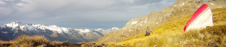
Getting started – St Arnaud
More or less what I had with me on this vol bivouac was the same as on other trips in New Zealand, but with a lot more food. I didn’t want to be tied down by food dumps and time consuming logistics, and I didn’t want to be limiting my flying by having to stay near roads. I had 2-3 days food tucked away and perhaps another week of food – basically whatever I could carry. My planning basically consisted of eyeballing it and lifting it in my arms in the supermarket – that’s pretty heavy, and most of it is >2000kJ per 100 grams so that will keep me going for a while. It’s a bit academic how much you take but it was good having a separate amount stashed away so I always knew I could land 2-3 days walk from a road. I had lots of peanuts, peanut butter, chocolate, muesli bars and plain old muesli, lollies and ginger nuts, shredded coconut, sultanas, and bread and cheese for the first few days. I also had some noodles but I didn’t bring a cooker due to time and space constraints.

Consumed and left over food
I can’t say how heavy I was before the trip but on completion I weighed 79kg, my pack was 23kg (mostly left over food, the photo above has just about everything except a few muesli bars, sultanas, and an empty pack of ginger nuts), boots and water excluded. I normally weigh 80-85kg so I probably lost a few kg but not too much as thankfully there was lots of flying.
We hitched in late and Kamila was intent on reaching the hut before dark so the first test was keeping up with her pace (even breaking step to run at times), to Lake Head hut by Lake Rotoiti. We cooked on the hut fireplace that night which was a little embarrassing due to the smoke. The next day was a little more relaxed but still quick, the weather deteriorating as we reached Upper Travers hut. This time we ate sandwiches with some fresh ingredients, onion and capsicum. It rained fairly heavy in the late afternoon but cleared late that evening. I was in position for a great weather forecast and primed for a flying start.
10 February – Upper Travers hut – 41km SSW
We were one of the last to leave the hut but still reached Travers pass much earlier than we needed to. Gusts of wind fanned around and even after reaching the pass and wandering around to some more exposed ridges from the flat-ish pass I had no idea which way the wind was coming from, only that I was in the lee. I decided to take off and find out. It was a little intimidating taking off from a somewhat enclosed site so to alleviate that I simply left all my supplies on the ground, and even gave Kamila the gopro to take some footage of me flying.

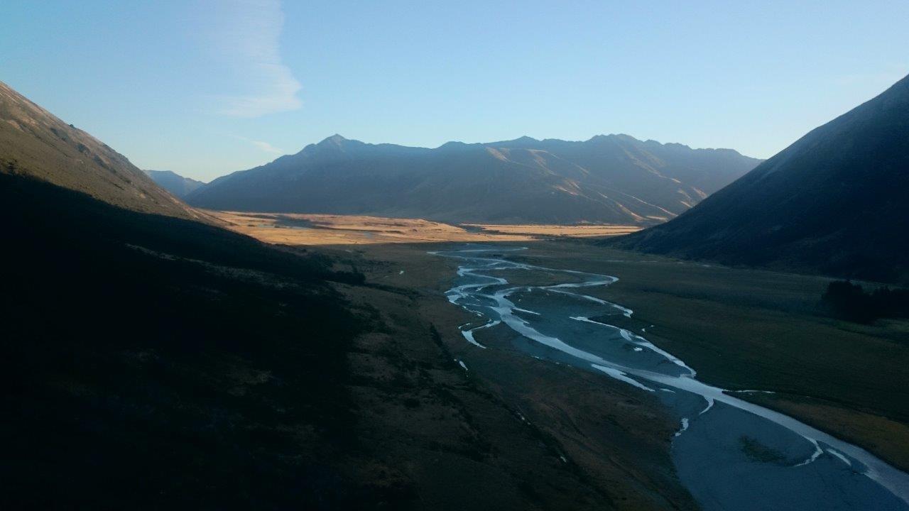
Travers valley from near the pass
It was nice to be light. Initially I sank below launch but soon enough I found lift and got high enough to make a small crossing to Mt Travers. But first I got a cravat that took around a minute to clear – quite unusual. The glide to Mt Travers was awful and I really had to work dodgy air over there to get high enough to come back. At that point I realised the wind was SE and of appreciable strength, as I pushed to get back to the pass (turning to land in the N wind on the pass).
By the time said my goodbyes to Kamila and I’d got myself ready to launch it was after midday and I thought the thermals should be strong enough to overpower the SE. They weren’t. Loaded up, I landed just above Upper Travers hut, Kamila showed up a few minutes later, and I had a quick second lunch.

Distant Tapuae-a-Uenuku from over Travers saddle
For my third flight of the day I needed to go somewhere else. Preferably out of the lee. Looking at the rocky pass to the SE I had doubts that it would be possible to launch on the other side (which turned out to be accurate – unfortunately no snow patches this time of year). So I surveyed my options from the next spur and saw my only option was to cross a loose west facing scree slope until I found a patch of grass (tussock). I knew it was working but it wasn’t until I got across the slope and climbed down to the tussock that I could launch. Then I went straight up to 9000’ and I was away.
The air was rough but looking down I could see the mountains were rougher. I was happy to be making progress. Unfortunately it was a little short lived though as 15 km south the southerly coming up the valley from Lake Tennyson washed away any chances of another thermal. I flew west across the valley, landed on the shady slope, packed quickly and walked up to the ridge. Again it was a worry as to whether I’d find a launch but luckily I found a spot with very small loose rocks (that won’t hold onto the lines) which was fanned by the southerly. I took off, pushed into the sunny lee, and climbed out for another 10 km flight south.

Landing north of Lake Tennyson
Instead of getting washed down into the valley behind a spur, I landed high in the lee of the ridge, packed, and climbed over the other side for an evening flight. The wind had dropped off now and all I hoped for was a glide into the valley where there was a hut by Lake Guyon. As I arrived over the top though I saw that I could exploit a convergence, so I managed to push a few more km south, landing in the shade in the Waiau valley.
Final glide, Waiau valley
In general the day was remarkably rough. Comparing with my Pyrenees crossing where I didn’t get a single collapse, here every flight I had a collapse, except for the final one where I launched at 7:28pm! It was consistent with the rugged rocky terrain, strong sun, and often leeside conditions, but still for February it packed a punch. It was great to have broken the umbilical though and set out on my trip.
With no time wasted and walking as fast as I could I reached Anne hut at about 10:30pm, using my UV pen torch (I’d brought my “first aid kit” which is mostly spare miscellaneous items such as spare lines, cable ties, etc) for the last part in the dark. It was lovely walking along the St James walkway, the well-trodden path just visible beneath the golden tussock. I washed my face and quietly shuffled into bed alongside slumbering Te Araroa walkers.
11 February – Anne hut – 138km SW
Less than eight hours after arriving I set off up the hill from Anne hut. Initially I thought I might get in a morning glide before my thermic flight. But the ridge I was on was working even early in the morning as I walked up, and higher up the ridge became broken so launching on the north and northeast faces became the obvious option.

Climbing up “Kamila’s hill” from Anne hut
Before the thermic flight is the obvious time to relax (eat!), since during other times of the day you can be rushing to beat the daylight. But perhaps I was impatient, overconfident, or curious about the conditions because I took off at 10:13am, a little early. It was working to an extent but ten minutes later I landed 250 metres lower on the spur I’d walked up. Not such a big deal normally but loaded up and with a shopping bag of overflow food hanging off my left carabiner, it was somewhat awkward. Having visions of slogging around in the heat, wasting myself on a hot day which happened to be Kamila’s birthday, I wanted to make sure I used my already committed brownie points wisely.


Relaunching at the more conservative 12:07pm I soon climbed up in a good thermal and set off following the ridge south, forgetting my thirst in the cool breeze. For the first part of the flight I was careful not to get too low. There was an uneasy moment when I was swept downwards before pushing bar to cross the valley and thankfully climb out again on Mons Sex Millia, just on the corner of the Lewis pass road. Here I tried to get as high as I could before the long crossing where again I had no trouble climbing onto the dry mountains north of Lake Sumner.
Strong rough air here, the mountains were keen to show me who was boss. The views were extensive. The Spencer mountains which I’d flown around the day before were a distinctive landmark in the north. Tapuae-a-Uenuku was unmistakeable in the northeast. The west coast had high cumulus clouds forming early. Over Lake Sumner I saw the dry hills which I’d flown the year before after paddling the Hurunui with my brother. You could see Banks peninsula in the distance to the east. And thinking of the topography, I could make out which distant hills to the south were the Craigieburn and Torlesse ranges.
Making good progress in a straight line clouds started forming around me and I saw the cloud drifts confirm that I was following a convergence line to the Craigieburns. The pronounced line of cumulus cloud there had been beckoning for over an hour.


Making my way to the Waimakariri river, I climbed high before crossing the valley and ducking into the sunny lee of the Craigieburns. Here instead enjoying the cloud street and continuing to fly straight to the Rakaia, I decided that crossing was a bit far and I needed to get deeper. I turned right and pushed low through cols to arrive on sunny faces. But unfortunately I couldn’t get the height I wanted just before crossing the Wilberforce (which feeds into the Rakaia), and ended up dribbling around after the crossing before landing, at 6:51pm, in a light westerly! What a shame, I’ll never know if that fanning breeze would have helped me to get the NZ open distance record, had I continued flying straight.


Anyway, I’d flown my best ever distance which was a good consolation for having missed Kamila’s birthday. I packed up and followed the farm track to Algidus station. Leaving my pack at a vacant shipping container (with a bed inside), I ran ahead to the station to ask if I could put my phone on charge. Peter Angland the station manager invited me for sausages, spuds, salad, hokey pokey icecream, and apricots – delicious – while we talked about the day and the country. I enjoyed a beer with Jim and the others in the workers quarters before a hot shower and a bed for the night.
12 February – Mt Algidus station – 39km WSW
Rather than be a purist and spend hours wandering over farmers paddocks and extensive river gravel flats trying to find a safe place to cross the Rakaia, I accepted a lift from Jim to his side of the river. The Rakaia was apparently low but I was pretty close to flipping on the last few metres as the swift water lapped around my waist. Soon afterward I was passing people camped on the Te Araroa trail again as I headed for the pass on the ranges north of Mt Somers, where I’d started an Easter vol biv many years ago.


The higher I got on the tussock slopes the less confident I was that the breezes on the tussock were anabatic lift. Indeed it was windy. Just before 11am I launched and pushed out of the NE winds in the bowl to get NW headwind as I scratched westward along the Rakaia. There was a lot of thermic activity but it was usually too windy to use effectively, until near the end of the flight where I followed the cue of some seagulls and got high. I couldn’t push very far at all though with the headwind and I landed after getting smashed behind the next spur. On the surface it was very peculiar to have had no mixing yet (landed the other way), when only a few hundred metres above I had been battling winds gusting 20 knots! They mixed in within half an hour of me landing, however.
I continued up the Rakaia, reminiscing about my previous vol biv in this area. This time I would go in the opposite direction, turning left toward Lake Heron. The wind was established now and I didn’t feel any need to rush the next part so I lay in the long tussock a while, watching the conditions. Boredom soon set in and I climbed up the tussock to find a launch facing the wind. It was a little low and quite gusty even though it was facing windward. But I was in a good spot, so I launched even though I knew it would be rough.
I was yanked off the ground and cast a few glances over my shoulder behind as I went straight up for several hundred metres. It was easy to get to the height of the peaks and I found that I had reasonable freedom of movement pushing into the wind at that height. Now it was time to enact my plan, of flying straight in the direction I wanted to go, hoping the features on the way would work in my favour as I’d planned. The idea is that the Arrowsmith range would afford me some shelter and take the brunt of the wind while I would hopefully find thermals hiding amongst the ridges.


After crossing the first valley I hovered around on the shoulder of the first mountain on my flight path. Beneath me was rocky slopes, leading down to broken gullies which normally wouldn’t pose a problem but were a scary prospect in changeable and turbulent winds. I’m generally happy enough in rough air as long as I have sufficient ground clearance and an understanding of the conditions sufficient to guarantee that I can get to a safe landing. The air itself can’t hurt you.
Anyway the air here was smooth enough and gradually I extended my envelope before I’d explored the whole slope, noting that there were face landing opportunities half way down without committing to landing in the bottom of the valley. A little longer and I was able to connect with a thermal which I was happy to take as high as I could. The views opened up and Mt Cook and Tasman offered a not so distant contrast to the barren landscape around me.
I was pretty pleased with myself – my plan was working! The wind was still flowing down the valleys from over the Arrowsmiths but there were thermals to be had on the way. I made about 15km to the SW, which doesn’t sound like much but it felt like a real achievement and certainly saves a lot of walking. I was eventually cut off by air flowing the wrong way through a pass so I spiralled down and landed at a hut just before 5pm, had a quick look, and continued by foot up to the same pass.

Deer on the evening walk to Potts hut
When I reached it in the late afternoon the winds had already changed – it’s remarkable how quickly everything changes as a few valleys turn katabatic. Now I had a slight tailwind and had to continue past the pass to find a launch. My flight was very short (under three minutes!) and in disgusting sinky air I didn’t even manage to reach the next hut. It was a nice walk though and I passed three deer before reaching Potts hut at 8:40pm. Dean, a solo mountain biker from Canterbury, was a little surprised to see me.

Potts hut
13 February – Potts hut – 145km WSW
I climbed out of the shade onto a river terrace to notice a light SE blowing. Modifying my route a little I went to the windward side of the spur, and realised that the day was getting thermic very early. It was a little crosswind where I was but rather than wasting time sidling around I thought it would be better to take off sooner rather than later.
At 9:29am I took off and started thermalling up the mountain! Clouds were forming early, showers were forecast for the afternoon, I was in the right place at the right time. I got a little stuck on the next spur as I struggled to get as high as the previous climb, given I had a long crossing of the Rangitata river coming up. I enjoyed good views of Erewhon station and the Lawrence River as I flew past familiar landscape from the previously mentioned trip.


Sunny cliffs on the Two Thumbs side of the Rangitata got me up again and I dived deeper, aiming for the col besides The Thumbs. Cloud base was lifting just in time for me and after a few minutes loitering in a high cirque I popped through into the Godley river catchment with views of Lake Tekapo. In a landscape of high rocky peaks, wide braided valleys, and high cloud base, I surveyed the scene. Clouds were building up to the north and lower cloud was spilling over into the Mackenzie basin from the east. Clouds looked good to the south too. With fifty kilometres flown before you’d normally even take off, it was on for another attempt at the NZ open distance record.
Using my airband radio for the first time, I occasionally took out a handwritten mud map with the calling points marked on them. As I approached the head of Gorilla stream close to Mt Cook airstrip and all the helicopter activity, I encountered a sharp burst of severe turbulence over the col. My wing forgave me and I looked around for an accompanying thermal but things were strangely silent. I made a run for it, gliding for the Wakefield spur beneath towering Mt Cook, and realising that I really should have been on the southern side of that prominent ridge.


In any case I could soar (and thermal) this southerly up on Wakefield and cross onto the Ben Ohau close to Mueller hut. I considered continuing along this range but didn’t fancy pushing from the lee of spurs so I dived into the Dobson. In a similar fashion I climbed over the Neumann range but getting out of the Hopkins valley wasn’t so easy. The southerly was washing any lift away so I had to drop downwind, climb up, and then sneak into a sheltered valley to get my next climb.


I saw a sailplane close to Broderick pass, and this was a cool moment of the flight and the whole trip, deep in the mountains, on the main divide, nudged up alongside the legendary Landsborough river and again in a place I’d never been before.
I pushed on into the Hunter valley to see Lake Hawea in the distance. Pushing speed bar I failed to get in front of a prominent spur and had to fall back again. Maybe I’d needed to sneak along the high peaks but it was never going to be easy with the clouds so close. I eyed up another col that would lead me into the Wills river.
Thankfully the southerly afforded me gentle soaring because without that I wouldn’t have had nearly enough height to breach the col. Continuing down the Wills valley I cruised along in buoyant air after the first sinky patch near the col. The views of the glaciated peaks across the Landborough were amazing. I recalled the last time I’d been near Mt Brewster, a couple of months earlier.


Reaching the Haast pass highway I now had to make a decision. Drifting back to the West Coast would not have been conducive to my plans to continue towards the Southern Lakes. I thought the Burke valley might offer soaring similar to the Wills, but it was full of forest and leading me into complete wilderness. Really my only option was to cross headwind to Mt Brewster.
I was carefully looking for signs and thinking about where the best place was to cross to the other side of the Wills valley. I got it right, sneaking across to Mt Brewster with hints of convergence with the southerly wrapping around various valleys. But after some lift on Mt Brewster in the lee I thought I’d exploited everything on offer, and I pushed around into the Makarora valley.
I did my penance and got hammered in the lee behind a sharp spur as I crossed back across the main divide. As expected the southerly was pumping, as I viewed the forest and flats separating me from Makarora. I did a little lap here but the southerly prevailed and I retreated, feeling like a punching bag as I regained height below the spur where I’d made my entry.
The day had a few hours left in it and I was sitting on 140km but I couldn’t think of any way out of where I was. Perhaps I could have kept away from the valleys and snuck along the high mountains but that was doubtful (in fact it the SE was too strong elsewhere and no one else really flew that day) and anyway I couldn’t get up that high again now. I crossed the valley to the east and ended up landing there ready for the next day, to start opposite Brewster hut.

Rock biv opposite Brewster hut
14 February – rock biv opposite Brewster hut – 24km SW
Expecting fine with light winds, I woke up at cloud base and it was completely overcast. Thinking things would burn off I followed the creek to the ridge, where it was a biting cold southeasterly. I followed the ridge to a good spot and waited, until about midday when I thought this was becoming ridiculous. I left my pack to go downhill and see what was happening with cloud base. It was rising finally so I returned, having to descend through broken slabs of rock to tussocky knoll perched on the edge of a cliff. I flew above the open grassy headwaters of Fish creek, thermalling beside launch to get back up to the height of the col where cloud base was now swirling around. Pushing downstream I viewed the deep forested gorge separating me from the highway. With no lift I had to retreat, finding a climb from low on the valley junction and getting back to base. This time I landed on the other side of Fish creek, in the lee, so I could climb to the pass and launch in the Blue creek catchment.


It was amazing terrain, the West Coast vegetation making it look so different to the hills of the previous days. Crossing rib after rib I finally made it to the pass and everything looked good – sun, wind – although I was still in the lee of the southerly coming from Makarora.
Taking off the thermals were beautifully smooth, in absolute contrast to the confused collection of clouds all going in different directions. I pushed upwind and the most jubilant moment of the trip was when I crossed the final ridge, leaving West Coast wilderness behind and seeing the wide river flats and highway stretch out before me towards Makarora. Perhaps overexcited I pushed forward, to soon get flushed in the valley with no hope of climbs with the wind over 15 knots.

Pushing towards Makarora and the road
Not motivated to walk along the highway, I was content to finish the trip and almost hitchhiked home. But I started to regret not trying to fly down the Blue valley and that gave me motivation to keep pushing out that way on foot. Only a few km south on the highway and I took the Blue Pools track to the Young valley and raced to the hut, seeing glow worms and an amazing sky full of stars in the last hour of the walk.
15 February – Young hut – 45km south
I’d hoped to find a warden at Young hut but instead I had to ask the patrons for a weather forecast. Luckily Thomo a local fixed wing pilot was there who could give me a little more detail than “it’s ok”, and even if he didn’t have the latest info it was interesting to chat with him about flying in the valleys we knew. But soon enough it was time to get going and I climbed up to Gillespie pass. It was hot and the clouds were beginning to lift.

Mt Awful from Young valley
I launched just before midday, and got a little low under Mt Awful before returning to the track spur to climb out. It was nice flying and a gorgeous area, but it was a little slow and cloud base was still well below Mt Alba. Crossing out to the Wilkin I decided I needed to be to windward of the valley wind flow so I headed east back towards Makarora.
The air was awful, lift, sink, broken, and I could never get above ridge height. Without completely understanding it I put it down to the Wilkin valley just being shit, and went with the NW cloud drift intending to fly along the McKerrow range.


Reaching Makarora though I got swept to the ground in an unexpected southerly, close to trim speed on landing. Very annoying and completely local to Makarora, with whitecaps on the head of Lake Wanaka but glassy further south. I continued walking on the highway for Boundary creek, which was a reasonable launch apart from the fact that the track doubled back on the way I’d already walked, and it was quite tricky to find a patch of grass without clumps of matagouri.
I launched at 4:36pm, somewhat delayed by snow berries, my substitute for bringing sufficient water. With the local southerly still present but diminishing I slowly followed the sunny cliffs higher, getting even further back (north) towards Makarora. I pushed back south across Boundary creek and luckily I found lift before having to exit from above the gorge. I continued north and finally got high over Sentinel peak. Here I got the first phone reception since crossing the Rakaia so I was quite content to spend a little more time doing turns in light lift.


Crossing to the peaks between Lake Hawea and Lake Wanaka south of The Neck, everything was rather sinky and disappointing, although I’d already expected to be somewhat disappointed. At the end of the range (Mt Burke) I lingered trying to get enough height for the final 16km glide to Wanaka. Try as I might I couldn’t get anywhere near the height I’d had at Sentinel, and I really felt like a beer.
Losing more height than I thought was fair on the way to the next little spur I climbed a little, but not enough, before setting out on final glide. After a minute I reconsidered and thought maybe I should have followed the peninsula instead, so I hastily turned back intending to try again. Then I was rather angry at myself as I got flushed and lost my remaining height, having to land on a very tiny beach on the lake beneath before pulling my wingtip out of a small leafy tree.
If I needed any humiliating incident to make me humble again after the recent good flights, this was it. The sun slowly dropped as I loaded up my pack and tried to scale the bracken and cliffs cutting me off from civilisation. Swimming up the slope with bracken below my feet and above my head and the airborne spores sticking in my throat, I heard a boat motor past… but scream and wave as I might, it didn’t hear me. Soon the worst of it was over though and I was just wandering through scrubby farmland, drenched with sweat.
In the last fading light, I found myself a few hundred metres over the peninsula inlet with Wanaka township visible in the distance. Despite a light katabatic, I desperately thought that maybe I could get off from the matagouri riddled slope. Nope. I had to pack in a hurry before it got completely dark, and I reached the beach by the lake very late indeed. Wading into the water and drinking it as I submerged my body was the substitute on offer for a cold beer tonight.
16 February – Lake Wanaka – back home
I rose just before my 5am alarm and I walked along farm roads in the pre-dawn. Reaching Burke station at 6:30am, the manager offered me a lift into town after milking his cow. I charged up and resupplied at The Flying Kiwi ready for another flying day. Taking off again from Roy’s peak I had a great run up the Matukituki and over Cascade saddle into the Dart, where I confirmed that this is still my favourite part of New Zealand. Having had a good start I attempted to smash the triangle record again but since I couldn’t get through the Kay ck saddle I fell back onto Alfred for a smaller version, and was doing alright for time but my preferred route was blocked by heavy showers over Treble Cone. They shaded the Motatapu valley so I fell short of the triangle by 10km but it was still good enough to be the highest ever scoring flight in New Zealand. Bryan picked me up, pretty stoked with my efforts of the last week, and another chapter concludes on a great season in New Zealand.


Hey Nick. Awesome trip man! Go for the pontoon in Monaco.
Thanks 🙂
Great adventure and brilliant writing…thanks for sharing Nick… regards ;D
Its great sharing. i like your writing and of course its a great trip. i would like to invite you in Bir Billing Himachal pradesh.India for paragliding World Cup Championship.