New Zealand is not known for its reliable weather. After two amazing summers the norwester returned to dominate. There was a treasured handful of good long flights but if you didn’t have anything else to do, times could have been tough with only one decent cross country during my last fortnight (first half of January 2017). Still, I love the fact that I can put down my wings and be a mountain goat for a day, or take the pack raft and float down rivers. Flying is still the choice way to get around though, and a few encounters with the wind resulted in a scary wave flight and a ride on the “yellow glider”.

Kea in strong winds
Moke lake Jan 2
I quite like Mt Crichton as a starting point, and didn’t carry through with plans to fly there on Christmas so felt it was worth a visit. I’d actually been for a couple of walks there on non flying days so it felt like my local. I also noticed it’s on the route of the Godzone event which starts today. The weather was fairly average in the end. I was ready to start flying fast as soon as the cloud lifted, but it took its time and I found myself in the lee, pretty impractical to go anywhere when clouds are drifting around ridge height.


I landed in dodgy air and walked to windward, launching again after a break on a steep tussocky pass. It was going to be another day of little skill tests but no spectacular flying. I managed to push upwind to north of Moke lake and tried my hand at patience and scratching out in crosswind, as the numerous general aviation air traffic flew past. It was pretty cool to see a big billy goat while I was flying that stood his ground, almost staring me down – an unusual display of confidence, he must be the king in those parts. After a little loop I decided to land and have a picnic, then I flew out and walked back to the car.
Jan 3, 4
A good excuse to catch up with family and friends.


I tried flying late on the 4th but yes, it was really too windy. Clearing southwesterly.
Glenorchy to Mt Cook Jan 5
With the winds dropping off we had a little crew for a hike and fly on the Humboldt mountains, west of Glenorchy. I took off first and it felt like I didn’t miss much, as I sunk a little below launch before climbing out. Once up I was super keen to fly as fast as possible so I didn’t wait for the others. Hitting Alfred was amazing, a few turns in a gully with a punchy leeside feel, then fast flying onto the summit.
From there I went to the ridge on the west side of the Earnslaw burn. Years ago David my brother flew into here, I thought he was pretty brave with a valley full of trees, and until this day I’d never done the same. It was working but it still felt like tiptoeing on thin ice until I reached the head of the valley. Here I had a problem – lift was topping out at the height of Lennox pass, which I needed to cross, and that was on the other (shady) side of the valley. If I was stuck, at least it was a spectacular place to be, and I flew right past the Earnslaw glaciers.


Under Lennox pass I could soar up gentle lift but it was really hard to slow down on this day that had been working so well. I was counting the seconds until I could reach Lennox pass. Finally I reached the altitude just as my lift petered out, and I went for it, thinking it was pretty doubtful but really not wanting to go back to boring soaring. I made it over by a metre or two, and that was the highlight of the flight.
Unlike the previous long flight, this time it was mostly blue and I could clearly see Mt Cook like a beacon in the distance. After breaching the clutches of the Earnslaw burn I was on my way again, and it was great fun flying through the upper Dart, past Rob Roy yet again, and diving through the Albert burn saddle to get a nice thermal in the likely place behind.
Left for the Lake Wanaka (closer to Makarora) crossing a little lower than I would like, and a poorly executed inflight pee. Hit Boundary creek really low but straight away into anabatic lift, the warmth of the slope was really noticeable. Some gorgeous and remote flying through the backcountry followed and I was still racing to cover as much distance as possible. Later I looked at Rick’s track, he was here, there, and everywhere – the scenic route – looked like a lot of fun. I was still exploring some unfamiliar country though, a mix of old and new.

Mt Barth, soaring close to the summit was a special part of the flight
We both reached the same spur on the Ben Ohau’s but I got there maybe a couple of hours earlier flying my direct line. Unfortunately however I was not able to get reestablished after the long Pukaki crossing, south of Aoraki Mt Cook, and I landed again in the Jollie. In hindsight I would have liked to fly deep up into the Murchison, but at the time I thought it was affected more by the northwest. The day still had a few hours in it and the cloud was not banked up – it was possible to break the record.

Head of lake Pukaki, Aoraki Mt Cook, and the Jollie (right)
Jan 6 mountain goat day
I moved my bivvy up from the non-existent hut on the map (the corrugated iron sheets were of some use), to another hunters hut, which was also a little run down but a much better place to shelter from any rain. Then I dropped the pack and made an excellent day walk loop behind Nun’s veil, crossing two high snowy passes on either side of the head of Gorilla stream with some killer glissades, and descending goat trails to the hut. It was windy and blustery, with some snow flurries up high – a great day for a walk.


Jan 7 flying the Ben Ohau wave
Tracks: Jollie valley, wave flight
The sky was a soupy grey in the morning. Rather than hike down the valley, I thought climbing up the alluvial fans to fly from the base of the cliffs might get me past the next patch of matagouri. It was a great surprise to find it was actually very lifty, and I managed to fly most of the way out of the valley despite the sun being totally obscured almost the whole time. The winds were breathing, up and down the valley.

Mt Sefton
I climbed through a dead forest (aerial spraying) out of the Jollie and over onto the Pukaki side of the ridge. It was still overcast but there was a few gusts of wind about on the ridge. I decided that I better hurry if I wanted to fly. The gusts were fairly brutal so I knew something might be up, but I took off in a lull and got some height before pushing out over the wide Tasman valley. I think the wave was starting to form at this time.
After getting a little height, which I needed, I decided it was time to push across the valley to reach the road and land. Pushing out though I found the strongest lift! Up to 10 metres a second at times, which is the paragliders normal horizontal speed. Quite rough, and for minutes at a time I was not game to free my hands to use the airband radio. I could hear them talking about me though, watching a Cessna pilot getting thrown about, who I later heard from again indirectly.

With high mountains and snow showers all around, I would have liked to push into the flats down the lake, but it was still basically overcast and getting up into the cloud would have been (even more) terrifying. A few rounds of spirited spirals at cloud base (10,000′) was far preferable to the prospect of no visibility, rough as hell, getting caked in ice, and being subject to the proper wind which could likely be at least twice as strong above the boundary layer.
In the end my only option was to go under the dark cloud, which is counter-intuitive to a paraglider pilot, but it was a wave rather than a convective cloud. A long glide followed and thankfully the air was flowing more horizontally behind the wave, so I got 90+km/h ground speeds and only gentle descent rates, enabling a very long glide over undulating tussock slopes, what would have been a very long and boring walk. I landed into a gentle breeze from a completely different direction, with only a short walk to the highway, quite happy to be safe and dry.

The distinct edge of the wave cloud
Jan 8-9
More wind, quite incredible at times…


Jan 10
A crap forecast and this was my last chance to fly, although originally I wrote off the day and had intended on going climbing (mountaineering day trip up Somnus). It turns out it was marginal after all, as I threw my reserve parachute. A few interesting points highlighting how well things went:
- Forecast for the rest of my stay was unflyable
- Not intending to fly the wing again, as it will be replaced for xalps
- Had my airband radio with me, on channel, with plenty of (helpful) air traffic in the area
- I was easily able to get to the trunk of the tree and climb down
- Landed a stone’s throw away from the track (completely obscured by forest, by the way)
- One of only a small handful of parties on the track that day happened to be right there!
- Mates were available on short notice to help out
- No damage to the reserve and didn’t lose the deployment bag
- I think the wing was damaged only during extraction from the tree
It’s pretty amazing, we’ve flown over hundreds of kilometres of mountains without seeing a soul this summer, and I manage to have this incident in the most convenient place I can imagine, with bystanders right there to help out!

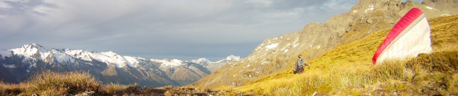
Mum flies the yellow glider
Jan 11-16
Dragged Mum up Turner creek in a search for the elusive waterfall (or even just the track.. so much windfall). She was in a rush to get back for guests arrival but they were cut off by the Glenorchy road fire.
I helped clear the water tank of 20 years of sludge (actually quite clean), visited the neighbours, friends, left the wing for repair, and got myself organised for a three day solo pack raft trip down the Dobson river.
Pack rafting the Dobson

Pack raft track log
I parked by the highway by Lake Ruataniwha just south of Twizel, the idea that I could paddle all the way back in time to make it to my flight home. In good time I hitchhiked with a young Dutch woman on a car relocation to Birch hill stream, just south of Mt Cook township. From here I moved fast, crossing the Ben Ohau range at Jamieson pass. It was great tramping. There was a little bluffy bit to negotiate (just a scramble) and then you wandered up to loose rocky stuff, Thar country, to the pass. A fast glissade down to a beautiful tarn with views of the wind and cloud pouring over Mt Hopkins, an impressive mountaineers mountain. Loose rock underfoot descending into the gulch, and then following the creek with unstable scree slopes and a few avalanche snow bridges on the way to Reardon hut. I really enjoyed the traverse and managed it well before dark in only six hours, however it could take a lot longer (really!) depending on fitness, confidence in rough terrain, and weather. You’d be advised to make use of those 16 hour summer days.


During the night in Reardon hut I had a rather scary experience where, completely alone, I was stuck in the hut with a jammed door. For half an hour I was aggressively kicking the door and even using the carpenters saw to cut my way out! In the end I bashed it open using a heavily built stool as a battering ram, which tore through the iron cladding until the door swung free. Sorry about that, hut…
Next day paddling was mostly great, although there was definitely a fair share of bum dragging when the river braided (such as downstream of Waterfall hut). I tended to stay onboard but had to push myself along with both hands – so a bit of extra water would be very welcome. Probably about half of the sections were trouble free however.
Waterfall hut is on a severe angle, worth checking out but you can’t really sleep like that unless you tie yourself to the bed. Kennedy hut (three hours downstream of Reardon) is in great condition and seems well used. I saw Grough hut in the distance but did not visit. Station hut (six hours from Reardon) was unlocked but you are asked to contact Glen Lyon station in advance, as with Le Crens hut further down the river (eight hours from Reardon).


The next days paddling (downstream of Le Crens) was great, you could stay in the boat and with judicious selection of braids I don’t remember any holdups. The norwester was back in force, and when it mixed in I could be paddling at full power and still get blown onto the riverbank. When the Huxley joined there was a serious amount of water, quite humbling to be in such a small boat. By the time I reached Lake Ohau the norwester was established and I was considering my likelihood of drowning or freezing to death. It was quite exhilarating being out in the chop, literally surfing the waves. A little scary when the sets came in and threatened to dip my nose under the water, but in the end I managed to stay in the boat.
Even with tailwind it was a long paddle to the corner half way to the lake outlet. I was so uncomfortable that I really appreciated the next part on foot, but once the muscles loosened up a bit I dropped off the gravel road down a steep embankment and got back into the water. On several occasions turbulent wind rotors lifted mini waterspouts on the water, but I never found myself within one. Reaching the irrigated canals the wind came and went, you’d occasionally just have to accept that you were going to get blown to the side of the canal. Again the waterspouts here and there, pretty awesome to see.


Further downstream the place was overrun with salmon fisherman and it was becoming a rather long and tiring paddle. Back onto lake for the final stretch to the car with a good tailwind, to wind up a massive mission – a huge distance covered. To think that I had an even longer route in mind when I was planning the trip….
So, what about the reserve parachute?
I submitted an incident report, and transcribed the video footage (full version is 20min), which I will include again below.
Suspected wind about, some in the forecast and some noticed while walking up the Sugarloaf track and on the pass. At launch it was sheltered from the wind by mountain ridges, I saw a bird (seagull?) thermalling up the Rock burn, and some cloud spilling over Park pass at about my altitude. Noticed it felt like lee when I was flying, thermalled up 1000′ or so and made a crossing. I think I had about half to three quarters speed bar, I was still high, just starting my glide across the Routeburn valley. This valley is exposed to northwest.
When high early in the crossing the incident happened – cravat too quick for me to react to, and seemed to be a difficult one to clear. Both which have not happened to me before to this extent! Tried stalling it a few times, perhaps not aggressively enough, but it did look pretty hopeless to me.
Was still able to control direction despite cravat, so headed towards the Routeburn car park to make life easier. When my altitude was running low, I threw the reserve. I was already on local airband radio, so I alerted the numerous GA traffic my location and that I was under reserve parachute. Landed in a high red beech tree, aware of my height I ensured my body position was upright with legs to absorb any impact (no injuries, very soft).
Conveniently a Dutch family heard me (!!) only twenty metres away on the track, and I asked them to hang around. Passing helicopter pilot offered (over radio) to call someone, asked to pass message on to Dave Watson (in Glenorchy). Meanwhile I teased my reserve out of the tree, disconnected the glider, and descended, with the aid of the Dutch for the last few metres. Reaching the ground I alerted GA traffic that I was safe and did not require further assistance. Changed SPOT from tracking mode to OK message. Hung sweaty clothes out to dry and ensured track location was marked, also started GPS track on phone. Radioed Dave on UHF as he drove past Lake Sylvan. Met him and Buzz’s son at the Sugarloaf track junction, with rope and a saw, and the glider extraction was very efficient and quite fun actually.
If I hadn’t had a reserve it’s probable I would have been able to land in the Routeburn car park with the cravat, but would have risked low level stall etc. Throwing the reserve over carpark would have risked landing in river. Didn’t expect this to happen (combination of too fast for me to respond in time, and unable to fix afterwards) but it was windy. However, others flew xc that day at less exposed locations such as Treble cone.
Timeline:
12:18pm Reserve deployment (impact 40 seconds later)
12:50pm Had removed reserve and tucked behind my back in the harness
1:10pm Down from tree (glider unclipped, still in tree)
2:05pm Back to tree with rope and belay buddies
3:35pm Back down the tree with the glider
By 5pm we’d watched the footage. Transcript follows
0:00:00.160,0:00:04.400
I’m just walking up Sugarloaf track, not far from the Routeburn turnoff0:00:07.660,0:00:10.780
quite a bit of wind coming and going in the trees0:00:10.780,0:00:13.880
it makes me a bit worried about the prospect of flying0:00:13.880,0:00:18.400
It’s now 11am, it took pretty much exactly two hours to get up here, going pretty fast0:00:18.400,0:00:20.400
just a short break at bushline0:00:20.400,0:00:24.180
I’ve just been watching a bird circling [climbing] there despite all this high cloud0:00:24.620,0:00:27.260
so I probably should get ready to launch0:00:29.840,0:00:32.840
It’s been pretty light in here0:00:33.380,0:00:38.100
don’t know whether it’s because it’s sheltered or not as windy as it was below0:00:41.200,0:00:47.920
it was light on launch but below the inversion there was quite a bit of wind, like 20-30km/h at the pass0:00:47.920,0:00:54.280
and in the air there is definitely something going on with air coming over [the mountains] right in front of me0:00:57.020,0:00:59.340
and making it leeside0:01:06.160,0:01:11.440
I had a collapse and I had to keep the wing flying out [away] from the cliff before0:01:16.900,0:01:21.940
but at the moment it seems alright. Definitely hands on brakes time though!0:01:28.400,0:01:32.720
Momus and Somnus that I was originally looking at climbing today0:01:33.180,0:01:35.460
.. I turned the car around0:01:41.640,0:01:45.000
I could try and throw the reserve, or stall it again0:01:45.000,0:01:48.560
[prior to this I had removed my overmitts, and flown closer to the carpark]0:02:17.200,0:02:19.920
[kept holding reserve handle, why not!]0:02:28.860,0:02:33.420
paraglider Routeburn carpark coming down under reserve parachute0:02:33.760,0:02:38.240
reserve parachute Routeburn carpark. Will be landing in the trees0:03:08.160,0:03:09.280
Are you alright?0:03:11.460,0:03:14.020
Can you see me? / Are you up there? / Yeah0:03:14.020,0:03:18.000
oh wow, yep I’m ok, I’m just going to let the guys on the radio know I’m ok0:03:20.340,0:03:22.660
I’ve safely, uh / can you come down?0:03:23.280,0:03:25.600
well I don’t know yet0:03:30.020,0:03:36.580
Glenorchy air traffic. Paraglider has landed in the trees, I’ve safely secured myself to the tree0:03:36.640,0:03:40.800
and I’m going to figure out how to get down off the tree from here0:03:45.360,0:03:49.600
paraglider pilot in the trees down there, SKB, are you ok down there?0:03:50.340,0:03:56.820
I’ve secured myself to the trunk and I’ll figure out what to do from here. I’ll stay on radio I guess0:04:01.700,0:04:08.700
yeah if you walk down the west, you’ll find the riverbed, you’ll be able to track it all the way to the bridge0:04:12.520,0:04:19.520
copy that thanks. There’s also some people on the track that saw me land, so they’ll probably be able to help out0:04:24.160,0:04:29.760
alright, so I’m going to try and figure out how to get myself safely down from the tree0:04:29.760,0:04:31.800
Routeburn paraglider pilot, copy?0:04:38.080,0:04:42.160
yeah this is Routeburn pilot, I’m holding onto the tree trunk0:04:42.720,0:04:46.560
ok do you want us to call anyone to give you some help there?0:04:49.840,0:04:51.840
[advice from below]0:04:53.440,0:05:00.440
at this stage I’m going to see if I can climb down myself, and work it out with the guys on the ground here, thanks0:05:02.420,0:05:07.700
ok, uh, just give us a bell if there’s anyone you want us to call, we’ll put a call through0:05:14.460,0:05:17.260
Are you hurt? / I’m not hurt at all / Good0:05:19.800,0:05:24.040
Um, but I might need some help getting down / yeah, we’ll help you0:05:33.840,0:05:34.640
um… right0:05:38.460,0:05:41.580
Are you by yourself? / yeah I’m by myself yep / OK0:05:43.080,0:05:48.280
HQW just approaching the mouth of the Routeburn, 2500′ towards Harris saddle0:05:53.980,0:05:57.500
HQW, SKB copy? / Yeah go ahead, SKB0:05:58.860,0:06:03.260
yeah just about a mile north of Routeburn carpark there’s a paraglider pilot,0:06:04.060,0:06:09.860
just landed in the trees there, he seems alright, but do you want to just call [?] for him?0:06:10.080,0:06:13.840
yeah no worries, has he got comms does he? / yeah he’s on comms,0:06:14.000,0:06:17.180
he’s got a radio there, he’s just holding onto a tree right now0:06:17.860,0:06:21.820
ok mate, well I can see where you are… / ok0:06:22.040,0:06:25.560
ok, and yeah, a big yellow parachute, pretty obvious0:06:25.920,0:06:29.920
just by the creekbed / ok, right up the gorge is he? / yep0:06:33.120,0:06:39.280
just for your information / yeah? / I’ve got an airband radio, so the pilots know that I’m here0:06:42.720,0:06:50.240
just looking quickly, like I’m quite high up, but I think it will be fairly easy to climb down0:06:51.580,0:06:55.420
it will be much harder for me to try and bring this gear down0:06:57.860,0:07:00.340
SKB, 1nm to the north of Harris saddle0:07:04.280,0:07:08.600
sorry what’s that? / does your gear have ropes that you could use?0:07:17.040,0:07:22.320
No I don’t, I’m just trying to think whether I try to get my gear safely, or just..0:07:23.480,0:07:27.400
if I come down I’ll probably try and come back up from my gear0:07:48.620,0:07:54.000
HQW, are you just about around that gorge? / 3000′, the gorge0:08:14.780,0:08:18.820
paraglider in the Routeburn, do you copy? / yeah, copy0:08:22.020,0:08:25.980
I’m at the gorge here, I can’t see you, but do you need assistance there?0:08:32.360,0:08:35.480
yellow parachute probably less than a km north of the carpark,0:08:35.760,0:08:38.520
at the moment I’m trying to get my stuff out of the trees,0:08:38.520,0:08:42.020
because at the moment I’m quite safely secured to the trunk0:08:46.360,0:08:50.760
do you need us to call anyone? someone could take a message for you?0:08:56.660,0:09:03.140
yeah I might get you to call someone for me actually, and he might be able to hike up and give me a hand0:09:03.140,0:09:07.340
but there’s actually already people here on the ground, coincidentally0:09:08.900,0:09:12.740
ok, if you give us a number there we can call someone for you0:09:45.220,0:09:48.180
yeah so do you need us to call someone for you?0:09:57.860,0:10:00.660
yeah if you could call Dave on 04………0:10:02.340,0:10:05.220
is that Dave Watson? / Yeah, that’s the one!0:10:05.960,0:10:11.080
yeah ok, we’ll give him a call and let him know you might need a bit of help there0:10:12.160,0:10:15.600
we’ll be able to call someone for you, I’ll call Dave0:10:15.600,0:10:22.320
yeah let him know I’m on channel 33, and he’ll be able to talk to me on that, from the Routeburn carpark or wherever0:10:23.320,0:10:25.560
ok mate, what was your name? / Nick0:10:26.320,0:10:28.720
ok mate, we’ll get a call out shortly0:10:30.260,0:10:32.340
great, thanks guys, heaps0:10:54.160,0:10:57.360
are you guys Dutch are you? / yeah we are / oh, cool0:11:00.320,0:11:03.360
yeah this doesn’t normally happen / oh, I reckon0:11:10.460,0:11:16.420
do you want to climb up? / yeah, it’s really quite high / yeah we can see0:11:16.420,0:11:20.240
but there’s quite a lot of branches and I can shimmy down the trunk I think0:11:21.040,0:11:26.560
I’m just going to see, if I’m really lucky my gear might jiggle or blow out of the tree0:11:27.580,0:11:31.900
why don’t you try to climb down, and get yourself down on the floor0:11:32.600,0:11:36.200
and then maybe there’s some extra rope or what have you0:11:36.880,0:11:39.440
so you can go in and get your gear after?0:11:42.440,0:11:46.920
at the moment I’m not hurt or anything and I’m kind of already up here0:11:54.780,0:11:58.220
this reserve is just about going to float out I think0:12:19.120,0:12:22.400
it’s pretty lucky that you guys are so close / yeah0:12:27.380,0:12:30.440
I don’t know if we can be of any help / sorry?0:12:34.960,0:12:36.560
it’s a bit hard to hear..0:13:12.880,0:13:15.600
I managed to tease the yellow reserve out0:13:17.120,0:13:20.080
this was the biggest stick that I had to break0:13:20.760,0:13:25.960
now I’m going to tuck [the reserve] behind my back and leave [the wing] up there0:13:27.500,0:13:33.500
so my Dutch rescuers have just thrown me this rope, they say it’s rated for hanging washing0:13:36.500,0:13:41.620
coming down here I just slid down this with my arms around it, it wasn’t too bad0:13:41.620,0:13:45.180
this is a bit big for my arms, it’s really thick isn’t it0:13:47.280,0:13:49.200
it’s a really good idea, guys0:13:58.940,0:14:03.820
try to put your right foot a bit more lower, there’s a hole in the tree trunk0:14:04.980,0:14:06.340
my right foot lower?0:14:10.540,0:14:13.740
now you can put your left foot on the other branch0:14:16.200,0:14:18.520
yep. Not sure if I can reach that far0:14:36.860,0:14:40.960
so it’s not going to fall that way is it? / no, no0:15:03.940,0:15:06.820
the left one, if you take the hand hold behind you, on your left0:15:08.860,0:15:10.860
put my hand where my left foot is? / yep0:15:15.780,0:15:18.800
get closer to the tree with your body / yep0:15:22.160,0:15:24.000
great, thanks a lot guys / ok0:15:24.780,0:15:28.940
oh wow, that was.. / you’re not done yet / .. excellent in the end0:15:32.660,0:15:34.500
well done / thanks very much0:15:38.680,0:15:44.520
so the boys have arrived to give me a hand, this is the tree, and it’s actually pretty high0:15:46.400,0:15:49.120
you can just see the glider right up there0:15:51.480,0:15:54.280
so I’ve just made my first protection here0:15:55.180,0:15:59.660
that’s a bit dodgy actually. Yeah this ideally would be a bit longer0:16:00.900,0:16:02.060
here we go0:16:13.720,0:16:14.600
come on… ah0:16:46.800,0:16:49.920
have you got the video footage on? / yeah I do now0:16:50.860,0:16:52.780
that’s the important thing!0:17:02.200,0:17:04.120
oh, like a koala! / just like a koala!0:17:12.260,0:17:15.780
that’s the kind of branch I need to not break… right0:17:16.200,0:17:20.820
just clipped myself in, and there’s plenty of wind around0:17:21.960,0:17:25.320
and it’s actually moving around quite a bit up here0:17:28.340,0:17:31.000
yeah nice tree this one0:17:36.960,0:17:38.120
ah, come on0:17:41.640,0:17:43.200
timber!0:17:47.120,0:17:49.960
oh, no! Sorry glider!0:17:49.960,0:17:55.680
I missed it on video, but I just chopped this branch here, and it was hanging off that one but only a few [lines]0:17:55.720,0:17:59.660
so I thought if the weight of the other two branches that I chopped pull down on it,0:17:59.660,0:18:04.340
it will come out… so it did, and it went boom boom boom slow motion and it hit the ground0:18:04.940,0:18:06.480
…to a little cheer!0:18:11.420,0:18:13.940
nice one. Tree swing0:18:14.360,0:18:17.400
it was good eh, thanks guys0:18:18.020,0:18:20.920
sure you don’t want a climb? / yeah0:18:23.200,0:18:26.960
it was a little bit hair raising, getting up there for you?0:18:26.960,0:18:32.880
yeah it was a little wobbly at the top, more wobbly than before because the wind has picked up0:18:36.600,0:18:39.480
and that lean out to the branch was a bit, …0:18:39.480,0:18:42.200
I think I had a sling on, the one you’re talking about, but yeah0:18:53.720,0:18:54.720
like a koala!0:18:59.000,0:19:04.360
so I’ve just had a look at the footage, and pretty remarkable how it all turned out0:19:04.480,0:19:07.720
hopefully that glider is fine, I haven’t checked it yet0:19:07.800,0:19:11.540
and yeah a pretty windy day down here0:19:12.860,0:19:17.580
but as I was saying, I’ve never had it happen before that it’s happened so quickly0:19:18.060,0:19:24.000
without me being able to react, and into such a, you know, the line over was so…0:19:24.280,0:19:27.160
like, I don’t know if I could have fixed that0:19:27.360,0:19:30.160
it’s a pretty unusual thing to happen, but0:19:30.180,0:19:34.180
apart from it happening, everything turned out really well

Pingback: Dobson River (I/II-) via Jamieson Saddle to Lake Ruataniwha – PackraftingTrips.NZ
Pingback: Choosing a new wing | Flying paragliders in the mountains